Visit our Social Sites or drop us an email:
Appalachian Trail Museum
  • Welcome
    • Directions, Lodging and Shuttles
  • About, Hours, etc.
    • Contact the Museum
    • Affiliates and Friends
    • Board of Directors & Staff
    • Corporate Governance
    • Hiking Around The Museum
  • Museum Store
  • Ironmasters
    • Ironmasters FAQs
    • Hostel Rates
    • Amenities
    • Private Guest Suite
    • Ironmasters History
  • News
  • Hall of Fame
    • 2022 Class
    • 2021 Class
    • 2020 Class
    • 2019 Class
    • 2018 Class
    • 2017 Class
    • 2016 Class
    • 2015 Class
    • 2014 Class
    • 2013 Class
    • 2012 Class
    • 2011 Charter Class
  • Online Museum
    • Research Library >
      • Appalachian Trail Museum Digital Library
      • Rules of Use
      • Catalogs
      • Research Contact
    • The Latest Buzz
    • A.T. History by Tom Johnson
    • A.T. Childrens Museum
    • Feature Articles
    • Select Trail Stories
    • Journal Project
    • Shelter Registers and Vintage Guides
    • Hiker Yearbooks - Exhibits
    • Photo Collections >
      • Class Photos
      • Individual Hiker Collections
      • Hall of Fame
      • Vintage Location Photos
  • Calendar
  • Support
    • Volunteer
    • Make a Bequest
  • Earl Shaffer Foundation
  • Videos

Chapter 3 - Pennsylvania’s role in creating the Appalachian Trail: Avery assumes control

9/3/2017

1 Comment

 
Picture
In 1929, the Pennsylvanians were suddenly visited by a force of nature.  His name was Myron Avery.  Avery radiated a unique manic energy that took the trail builders in the Quaker State by surprise.   

Myron Avery, a young lawyer, had come from Maine by way of Harvard Law School.  He arrived in Washington D.C. around 1926 (we are not sure of the date), and quickly appeared on the local hiking scene.  It was said that no one could hike as fast as Avery.   

In 1927 he became one of the six founders of the new Potomac Appalachian Trail Club (PATC), and began scouting the route of the A.T. southwest of Duncannon.  He was joined in this by one Frank Schairer, a recent Yale graduate.  Those who encountered Schairer were overwhelmed by his enthusiasm.  With Schairer, Avery now had the perfect trail companion.
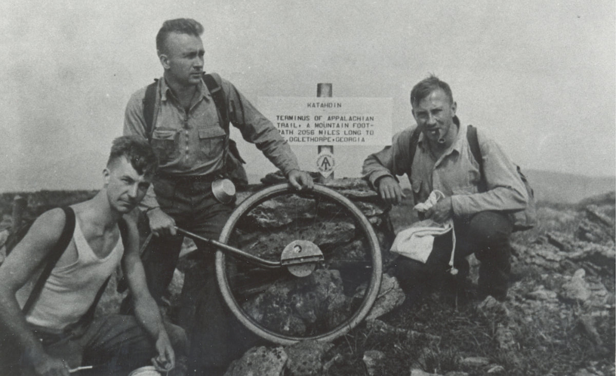
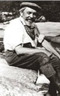
​                                                                           Myron Avery             
Picture
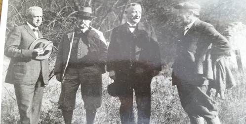
Avery (center), Frank Shairer (right) and an unknown companion, on Katahdin
​
Picture
The Pennsylvanians originally planned a route for the AT on Blue Mountain from Delaware Water Gap at the Pennsylvania-New Jersey line, all the way to the Potomac River.  That route would have avoided Cumberland Valley, with its houses and farms, staying on the ridges north of the valley – Blue Mountain, Rising Mountain, Tuscarora Mountain.  Much of it was private land at the time, although Pennsylvania was creating state game land and forests at a remarkable rate.
​
Avery looked at the plans, and rejected them.  In 1929, he wrote to Arthur Perkins, the chairman of the board of managers of ATC, that he intended to put the trail across Cumberland Valley, and into Michaux State Forest, and Perkins approved.  Avery turned the trail into the valley at Lambs Gap on the Darlington Trail.  Wasting no time, he and Schairer painted blazes on roads across the valley (some are still visible) to a route that is no longer part of the AT. (Today it is called the White Rocks Trail.) 
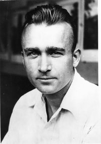
Arthur Perkins
​
​Coming to the top of the ridge, it turned toward Pine Grove Furnace, an iron smelting works that had been closed in 1874 after a century of operation.  A state park had opened there in 1921.  To Avery’s idea, the trail should continue on through the states forest, all the way to the Pen Mar Park on the Maryland-Pennsylvania line.  A popular tourist destination, it, too, would be an ideal place for the trail.  ​

Avery found colleagues in the state forests.  He formed a bond with forester Tom Norris of Mont Alto and Tom Bradley of Michaux.  The foresters suggested a preliminary route using old roads. The irrepressible Avery was out on the suggested route, accompanied by Schairer, almost immediately, hiking Pen Mar to a point just north of the Big Flat fire tower.  “We were extremely pleased with the route selected.  It is Appalachian Trail caliber in every way,” Avery wrote to Bradley.”[1]
​

The official route through the two forests was marked by two parties of state foresters, in February of 1931.  One group began walking north and the other walked south.  Later in the month, a bus load of 45 enthusiastic PATC members invaded Mont Alto Forest to walk 12 miles of the new trail, led by Tom Bradley.[2]  The interaction between PATC and the two groups of foresters was very smooth, and before the end of 1931, there was an established route of the A.T. all the way across Pennsylvania.  It was one of Avery’s most successful and enduring partnerships, probably because he let the public officials lead.   


[1] Avery to T. G. Norris of Michaux, Dec 23, 1930.  White blazes can still be seem along the old route.

[2] Gettysburg Star Sentinel, Mar 14, 1931.
1 Comment

Chapter 2 - Pennsylvania’s role in creating the Appalachian Trail:  The Skyline Trail

8/31/2017

2 Comments

 
Gene Bingham had an idea.  Head of the chemistry department at Lafayette College in Easton Pennsylvania, he was a widely-published writer of the subject of research chemistry.  Then, at 1926, at the age of 46, he pushed his life in a completely new direction.

North of Easton was a rocky ridge about 2,000 feet in height.  Blue Mountain Eagle Climbing Club (abbreviated BMECC to avoid the tongue-twister official name) had begun building a hiking trail on the ridge, called, needless to say, “Blue Mountain.”  The ridge ran from Delaware Water Gap, the border between Pennsylvania and New Jersey, all the way to the Potomac River in Maryland.  The ridge line was periodically punched by gaps, forcing the hiker down into the gap and up again.  But, though the trails that BMECC were building might be steep in the gaps, they were very moderate along the ridgeline.  It made for almost ideal, though somewhat rocky, walking.

In 1926 Bingham established a hiking club at Lafayette College, called Blue Mountain Club (not to be confused with BMECC despite the similar name).  Bingham, who had heard about Benton MacKaye’s new trail project, contacted BMECC and asked them to join his club in building the new trail from Delaware Water Gap to the Susquehanna River.  BMECC leaders met with Bingham on October 30, 1926, after the annual hike to the spot of the eagle’s nest.  Bingham’s club had already adopted the project to build a 35-mile section from Delaware Water Gap to Lehigh Gap, and suggested that it would be a great idea for BMECC to take on the rest of the project, 102 miles to the Susquehanna.   Rentschler took the lead, and the club plunged enthusiastically into the project.  The first work trip was recorded in Rentschler’s diary.

Sky Line Trail - 1st training, Sunday, Nov. 21, 1926. Members: Wm. R. Shanaman, Truman Temple, S.I. Goss, D.K. Hoch, Nick Phillipson, H.F. Rentschler, E.D. Greenawalt, Wm. Burkey, John O. Baer and nephew, Clarence Rahn. Left Reading at 9 o’clock; parked machine at John O. Baer home, Mountain, 10:45.  Proceeded up the mountain.  The trail was started by placing a marker close to the Berks and Lehigh Co. marker.  Proceeded westward for ½ mile on the Drech road……to the high point known as Baer’s Ridge.[1]
​

            In five years BMECC was ready to open the 20-mile section west of Port Clinton.  This Berks section of the Appalachian Trail was formally dedicated on October 12, 1931.  Benton MacKaye himself was present for the occasion.


[1] Rentschler diary, entry provided by Barbara Wieman Dec 30 2015.  The site of the marker can be located with fair precision on the current ATC trail maps.

Picture
The trail in Pennsylvania was known originally as the Sky Line Trail, so named by the Blue Mountain Club.  Its route from Delaware Water Gap to the Susquehanna faithfully followed Blue Mountain, moving along the relatively level ridgeline, through Lehigh Gap, Swatara Gap, and Manada Gap before reaching the river just north of Harrisburg.  At this point it needed to connect with the Bishop Darlington Trail across the river, named for the Episcopal bishop of St. Stephens Cathedral in Harrisburg, and a prominent member of the Pennsylvania Alpine Club.  But there was no direct connection - hikers either had to walk south to Harrisburg, cross the river on an auto bridge, and walk back north, or cross illegally on a railroad bridge that took it almost directly to the foot of Blue Mountain on the west bank of the river, where the Darlington Trail began.  (There is no information about how many hikers dared to use the illegal and dangerous Rockville railroad bridge crossing (shown to the left).  But it was there, and hikers tend to be adventurous.) 


​          Rockville Bridge – The Chancy Route[1]

Pennsylvania thus had a long section of the AT built in the late 1920s and early 1930s.  But the route west of the Susquehanna River confronted a problem that was to confound trail clubs for decades.  South of Blue Mountain and the Darlington Trail was Cumberland Valley, farmland and private property. It would be difficult to bring a trail down through that area, so the Blue Mountain Club proposed to extend it along Blue Mountain all the way to Doubling Gap (present-day Colonel Denning State Park), then hooking down past Newville and south of Carlisle, a 30-mile road walk all the way to Pine Grove Furnace.  From Pine Grove Furnace, Bingham’s map showed it proceeding along South Mountain, through the new Michaux State Forest and Mont Alto State Forest, and into Maryland at Blue Ridge Summit.  Bingham’s proposed route took the trail all the way to the Potomac River three miles east of Harpers Ferry.

The ideas were admittedly primitive and not fully formed – perhaps Bingham himself would have admitted it.  But, west of the Susquehanna, a new player emerged.  Myron Avery, a 30 year-old lawyer, burst onto the scene, and the Appalachian Trail in Pennsylvania was never the same.
  
[1] Rockville Bridge was the longest stone-arch bridge in the U.S.

2 Comments

Chapter 1 - Pennsylvania’s role in creating the Appalachian Trail

8/31/2017

0 Comments

 
​The Appalachian Trail began in New England and New York, and the first officially-designated section of the AT was the Ramapo-Dunderberg section in southwest New York in 1922.  But the plans for a specific route for Benton MacKaye’s proposed trail stopped at Delaware Water Gap, the boundary between New Jersey and Pennsylvania.  How it came to Pennsylvania is a remarkable story.

Hiking in the Quaker State began very early, and we have records of trail clubs prior to World War I.  Hiking came naturally to Pennsylvanians.  The state’s mountains resemble a rug kicked into folds, running from northeast to southwest, and the ridges attracted generations of hikers.  The ridges were very old in geologic terms, and in many places were worn down to the underlying rocks.  Hikers complain about the rocks in Pennsylvania.
​
But that seemed not to deter native Pennsylvanians, who are perhaps a sturdier lot than the rest of us.  The first trail club of which we have records is the Blue Mountain Eagle Climbing Club, founded by one Dr. Harry Rentschler. 
​ 
Picture
Left to right:  Harry Rentschler, Raymond Torrey, William Shanaman and Arthur Perkins
​

This classic photo is of Rentschler with three of the founders of hiking in the East:  Raymond Torrey, who headed construction of the AT in New York and New Jersey; William Shanaman president of BMECC (curiously, Rentscher was never the president of the club he founded); and Arthur Perkins, about whom we will learn a great deal more later on.

Supposedly Rentschlder had found an eagle’s nest on Blue Mountain near Shartlesville (a small town northwest of Reading), and the Fussgangers (German for walkers), a local hiking group led by a former mayor of Reading, decided to climb to the spot where Rentschler had seen the eagle’s nest.  When they arrived, on June 15, 1916, there were no eagles.  (Some say the nest was still there, but even that is uncertain.)   In October of the same year, they returned, and formed the Blue Mountain Eagle Climbing Club (BMECC).  It was a local trail club, dedicated to building a hiking trail atop Blue Mountain.  (Hiking clubs hike - trail clubs also build trails.)  Benton MacKaye had not yet proposed the AT (his proposal came out in 1921), and BMECC had no sense that it might be a part of something much larger.

The other early club was the Pennsylvania Alpine Club, established a year later, in 1917, as the first state-wide hiking club.  The founder was a rich and eccentric New Yorker named Henry Shoemaker.  Shoemaker moved to McElhatten, PA, where he published newspapers.  His club grew to over 2,500 advocates across the state, and the Harrisburg Chapter built the Darlington Trail, which was to become the first designated section of the Appalachian Trail in Pennsylvania.[1]  The club, dominant in the early years, disbanded in the late 1930s. 

The Pennsylvania Alpine Club was long on promises, but short on accomplishments.  Arthur Perkins once wrote to Myron Avery that:

"I am a good deal amused by the report of the meeting of the Pennsylvania Alpine Club.  You know I was out there a year ago when they had a meeting…As perhaps you can imagine, a mountain club which requires a Grand Chaplain, a Chief Guide, and a Chorister and a Poetess, is not exactly the kind of a club that we are used to….Add to this the fact that all the members of the Alpine Club are members of the Pennsylvania Folklore Society, and you won’t be surprised that they do a good deal more talking than climbing."

So, when Benton MacKaye published his proposal for a new trail the length of the Appalachian Chain, the Pennsylvanians were already out there, building a section of trail that would become the AT.
 

[1] One of the best accounts of early hiking in Pennsylvania, and of the Pennsylvania Alpine Club, can be found in Silas Chamberlain’s MA thesis.  Pennsylvania History, “’To ensure Permanency’:  Expanding and Protecting Hiking Opportunities in Twentieth-Century Pennsylvania.”  Pennsylvania History, Vol 77, No. 2, 2010.  Shoemaker’s biography was found in Wikipedia.

Next:  The Skyline Trail in Pennsylvania
0 Comments

    A.T. History

    By Tom Johnson

    Archives

    September 2017
    August 2017

    Categories

    All

Home

About

Store

News

Contact

Copyright © Appalachian Trail Museum, Inc.